
The following will define the local-intake area of this school from 2018:
From the junction of Bordeaux Lane and Farnborough Parkway, east along Bordeaux Lane (south side included) to Vines Avenue, south along Vines Avenue (west side included) to a point midway between Bordeaux Lane and Shiraz Lane, north east along the centre of the nearby 11th fairway to the 10th fairway, east along the centre of the 10th fairway through the centre of the tennis courts to Hermitage Drive, south along Hermitage Drive (west side included) to a point between 96 Hermitage Drive and 108 Hermitage Drive, north east from this point to the golf green of the nearby 13th hole, east from the 13th hole to the intersection of the Ellen Brook and the western extension of Apple Street, south along the Ellen Brook to a point on the western extension of Cruse Road, west south west from this point on Ellen Brook along the greenbelt/water course to the junction with Egerton Drive, south west from this junction across the greenbelt to the junction of Zanzibar Loop and Tullawood Drive, north along Tullawood Drive (east side included) to Wistful Parade, west along Wistful Parade (north side included) to Henley Brook Avenue, north along Henley Brook Avenue (east side included) to the intersection with The Promenade and Millhouse Road, east along Millhouse Road (south side included) to Ellery Gate, north along Ellery Gate (east side included) to Safford Avenue, east along Safford Avenue (south side included) to Delaney Road, north along Delaney Road (east side included) and its northern extension through bushland to a point in that bushland that is south west of the junction of Doig Road and Holdsworth Avenue, north east from the aforesaid point to the junction of Doig Road and Holdsworth Avenue, north along Holdsworth Avenue (east side included) to Maffina Parade, east and north along Maffina Parade (south and east sides included) to Bordeaux Lane and east along Bordeaux Lane (south side included) to Farnborough Parkway.
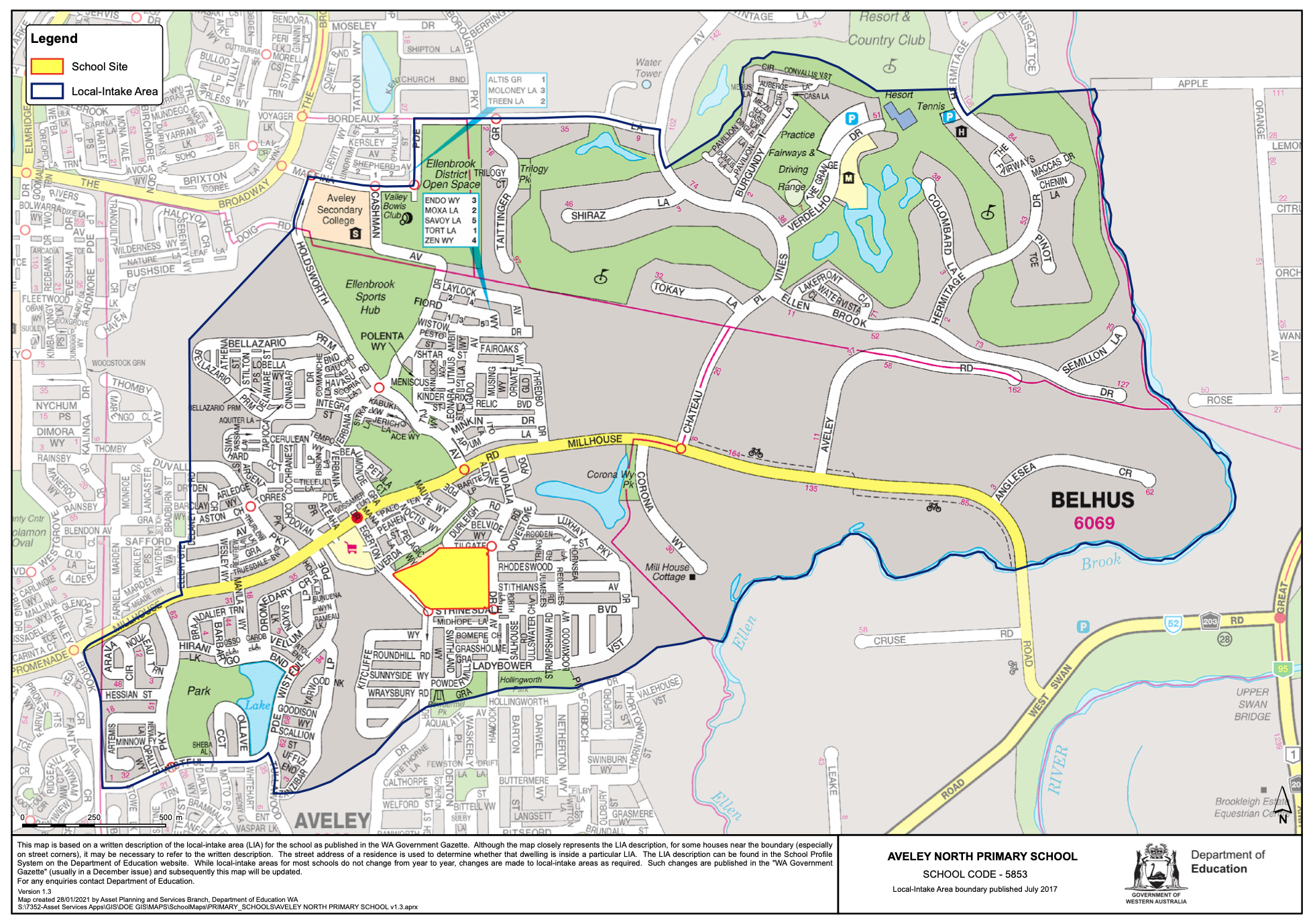
Note:
The local-intake area maps are based on a written description of the local-intake area (LIA) for the school as published in the WA Government Gazette. Although the map closely represents the LIA description, for some houses near the boundary (especially on street corners), it may be necessary to refer to the written description. The street address of a residence is used to determine whether that dwelling is inside a particular LIA. While local-intake areas for most schools do not change from year to year, changes may be made to local-intake areas as required. Such changes are published in the WA Government Gazette and subsequently the local-intake area map will be updated.